


In June 2017, a vessel approaching the Russian port of Novorossiysk reported something highly unusual. Instead of showing its actual position at sea, the ship’s GPS indicated that it was located nearly 30 kilometres inland at an airport. The crew initially suspected an equipment malfunction. However, when multiple nearby vessels reported the exact same issue, it became clear that this was no ordinary GPS failure. It was one of the earliest widely documented GPS spoofing incidents in the maritime industry.
Over the past few years, similar events have been reported in the Black Sea, the Eastern Mediterranean, the Strait of Hormuz, and other strategically important waterways. As ships become increasingly dependent on satellite navigation, cyber-enabled interference with Global Navigation Satellite Systems (GNSS) is emerging as one of shipping’s most significant operational risks.
Why GPS spoofing has become a growing maritime threat
Modern vessels rely on GNSS for far more than displaying a position on an electronic chart. Navigation, Automatic Identification System (AIS), route optimisation, dynamic positioning, electronic logbooks, and numerous onboard systems depend on accurate positioning data.
When those signals are manipulated, the consequences extend well beyond navigation.
Unlike GPS jamming, which blocks satellite signals entirely, GPS spoofing transmits counterfeit signals that deceive a vessel’s receiver into calculating an incorrect position or time. Everything onboard may appear normal, while the navigation system is quietly being fed false information.
This makes GPS spoofing incidents particularly dangerous because crews may not immediately recognise that the information they are relying on is inaccurate.
Case Study 1: The Black Sea GPS Spoofing Incident
The 2017 Novorossiysk event remains one of the most referenced Black Sea GPS spoofing cases.
According to reports, more than twenty vessels simultaneously experienced incorrect GPS positions. Some electronic navigation systems placed ships several miles from their actual location, while others displayed positions well inland. Since multiple vessels were affected at the same time, investigators concluded that deliberate spoofing was the likely cause rather than isolated equipment failure.
- The incident demonstrated several important lessons:
- Multiple vessels can be affected simultaneously.
- Standard GPS receivers cannot easily distinguish authentic signals from sophisticated spoofed signals.
- Navigation errors can occur even when onboard equipment appears to function normally.
- Verification using radar, visual bearings, gyrocompass, and other independent navigation methods remains essential.
The incident also highlighted how GNSS disruption along shipping routes can affect commercial operations without causing a collision. Even temporary uncertainty can lead to slower navigation, operational delays, and increased safety risks.
Maritime navigation failures are no longer just technical problems
As ships become more digitally connected, navigation data feeds multiple operational systems.
Incorrect positioning information can influence:
- Voyage planning
- Dynamic positioning operations
- Port approaches
- Fleet monitoring systems
- Cargo scheduling
- Shore-side operational decisions
This is why modern maritime navigation failures increasingly involve both navigation technology and cybersecurity.
Instead of asking whether a GPS receiver is functioning, operators must also ask whether the information it receives can be trusted.
When ships appear in the wrong place
One of the clearest signs of spoofing is when ships show the wrong location due to GPS spoofing.
This can include vessels appearing:
- Inland instead of offshore
- Hundreds of metres away from their true position
- Moving when they are actually stationary
- Following impossible navigation tracks
These anomalies affect not only onboard navigation but also fleet tracking systems that rely on AIS position reports.
Case Study 2: AIS Spoofing During the Strait of Hormuz Tensions
Another important example emerged during periods of heightened geopolitical tension in the Strait of Hormuz and the Persian Gulf.
Security organisations and maritime intelligence providers observed vessels transmitting inconsistent AIS positions, unexpected course changes, and inaccurate location data. In several cases, ships appeared to “jump” between positions or display movements that did not match their actual navigation.
While investigations often involve multiple contributing factors, these events became some of the most discussed AIS spoofing cases in recent maritime security reporting.
For ship operators, the operational impact was significant:
- Vessel tracking became less reliable.
- Fleet managers required additional verification before making operational decisions.
- Navigation teams had to cross-check multiple sources of information.
- Risk assessments became increasingly dependent on independent situational awareness.
These real examples of GPS spoofing in the maritime industry demonstrate that cyber-enabled navigation interference is no longer a theoretical concern. It is an operational challenge affecting commercial shipping today.
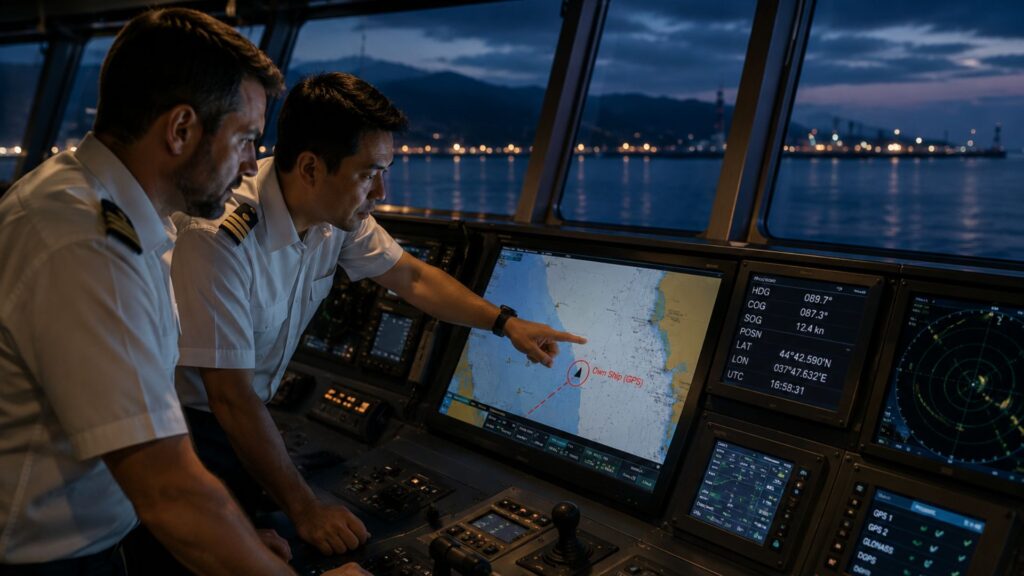
Can ships’ GPS systems be hacked?
When people ask whether ships’ GPS can be hacked, the answer requires some clarification.
In most documented incidents, attackers do not compromise the vessel’s navigation equipment itself. Instead, they manipulate the satellite signals that the equipment receives.
The GPS receiver continues operating normally but calculates an incorrect position because it is processing counterfeit satellite information.
This distinction is important because it means even well-maintained navigation equipment can become vulnerable when operating in affected regions.
Reducing the risk through layered navigation resilience
No single technology can completely eliminate spoofing risk.
Instead, ship operators increasingly focus on building resilience through multiple layers of verification.
These include:
- Cross-checking GPS with radar, visual navigation, and gyrocompass information
- Monitoring AIS behaviour for anomalies
- Comparing multiple independent positioning sources
- Maintaining crew awareness of high-risk geographic regions
- Continuous monitoring of onboard navigation systems
Early detection often depends on recognising inconsistencies before they become operational problems.
How Station Satcom helps fleets navigate GPS disruption
As maritime cyber risks continue to evolve, connectivity providers are also becoming trusted partners in operational resilience.
Station Satcom supports ship owners through integrated navigation, communication, cybersecurity, and fleet connectivity solutions designed to improve situational awareness and reduce operational risk.
Its portfolio helps operators strengthen resilience through:
- Multi-layered maritime connectivity, enabling access to multiple positioning and operational data sources.
- Managed cybersecurity services, helping identify and respond to evolving cyber threats affecting shipboard systems.
- Fleet IT management through Station 365, providing consistent monitoring, system management, and operational visibility across vessels.
- Station SecureX, delivering cybersecurity oversight, endpoint protection, and security monitoring to strengthen digital resilience.
Expert support in designing integrated communication systems that continue operating even when navigation environments become more challenging.
Rather than treating navigation, communications, and cybersecurity as separate disciplines, Station Satcom helps ship owners build a more resilient operational ecosystem where information can be verified, monitored, and acted upon with greater confidence.
Preparing for the next generation of navigation threats
The shipping industry is entering an era where cyber resilience is becoming as important as seamanship itself.
From the Black Sea GPS spoofing event to more recent AIS spoofing cases, history has shown that navigation systems can no longer be taken at face value. Building resilient operations now means combining crew expertise with reliable connectivity, cybersecurity, and continuous monitoring.
If your fleet operates through regions where GNSS disruption along shipping routes has been reported, now is the time to evaluate your navigation resilience.
Station Satcom helps ship owners strengthen operational continuity through integrated maritime connectivity, cybersecurity, and fleet IT solutions that keep vessels informed, connected, and prepared for an increasingly complex digital maritime environment.
To learn how Station Satcom can help protect your fleet against emerging navigation and cybersecurity risks, contact sales@stationsatcom.com for a consultation with our maritime connectivity specialists.